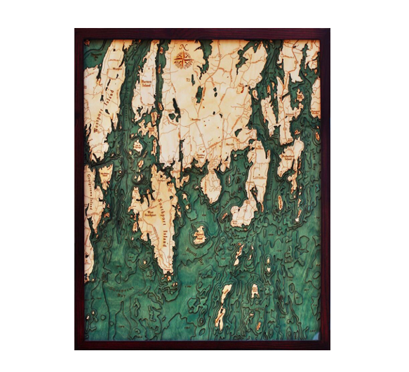
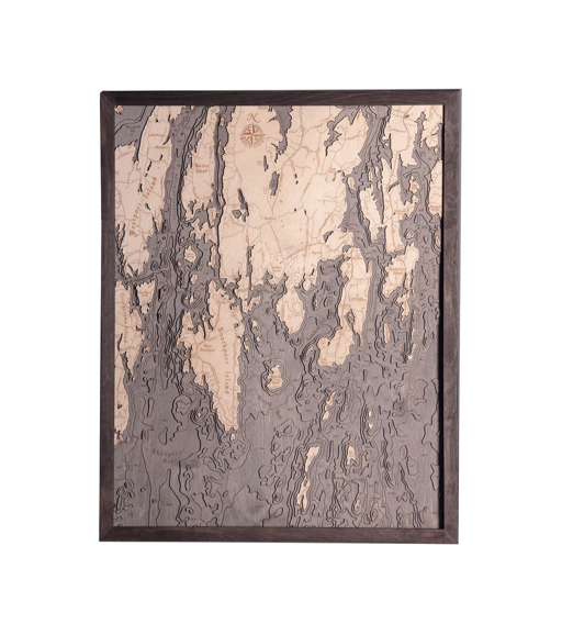
Boothbay Harbor, Maine, a popular destination for yachting and the largest boating harbor north of Boston, offers a picturesque landscape for those longing for the New England coastline. With hundreds of boats docked at any given time, the port is known to many as the Boating Capital of New England, thanks to its positioning between Casco Bay and Penobscot Bay. Our 3D nautical wood map depicts the incredible topography of the ocean floor around Boothbay Harbor and neighboring islands.
Each 3D nautical wood map is intricately made using laser-cut layers of Baltic birch that are glued together to create the depth and dimension that makes our 3D wood maps a customer favorite. Once the layers are complete, the area modeling the water is hand-stained a beautiful blue-green color while the land is etched with points of interest, roads, and landmarks. The lake art is finished with an ultra-transparent acrylic glass top and custom solid wood frame.
Hang this incredible wood map of Boothbay Harbor and allow it to serve as a constant reminder of your love of the water.
| Dimensions: | 24.5" x 31" |
| Material: | Baltic Birch wood & Plexiglass |
| Features: | 3D underwater topographic map (bathymetric chart) | Layered laser cut natural Baltic Birch wood | Carved relief of nautical terrain | Wooden chart work of art that will enhance any décor | Locations etched & highlighted | Color may vary slightly |
| Care: | Damp cloth wipe, do not use chemicals or detergents |