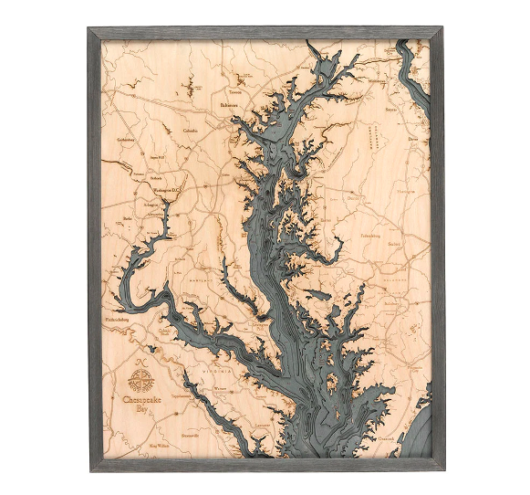
The Chesapeake Bay was created more than 12,000 years ago when the Susquehanna River valley was flooded by melting glaciers. Home to the largest estuary in the United States, this coastal community is known for fishing, watersports, and incredible sunsets.
Our 3D nautical wood map of Chesapeake Bay features laser-cut layers of Baltic birch that have been glued together to create the stunning visual depth of the lake’s topography. The water is hand-stained, and points of interest and major roadways are etched into the wood’s surface. This nautical wood map is one of the most precise and detailed you’ll find, and each piece is finished with a custom wood frame and ultra-transparent acrylic for maximum durability and protection.
Recall the relaxing sound of the beauty of Chesapeake Bay with our 3D wood map.
| Dimensions: | 24.5" x 31" |
| Material: | Baltic Birch wood & Plexiglass |
| Features: | 3D underwater topographic map (bathymetric chart) | Layered laser cut natural Baltic Birch wood | Carved relief of nautical terrain | Wooden chart work of art that will enhance any décor | Locations etched & highlighted | Color may vary slightly |
| Care: | Damp cloth wipe, do not use chemicals or detergents |