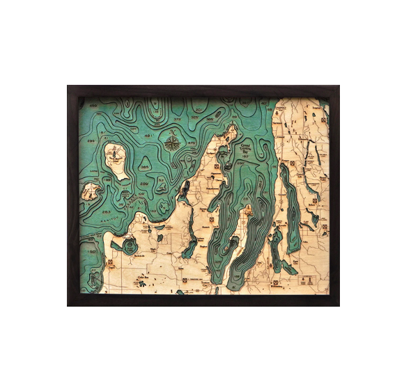
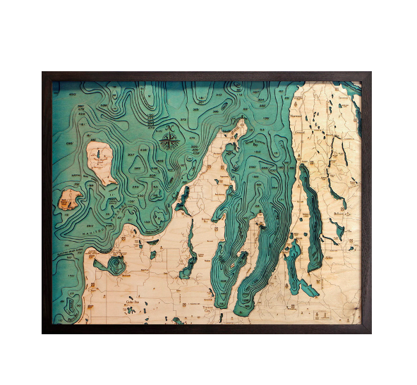
Grand Traverse Bay was formed by the Leelanau Peninsula and is divided into several smaller bays by the arms of the Old Mission Peninsula. A historic lighthouse marks the entrance to the bay, which got its name from eighteenth-century French explorers who crossed the bay in what they called la grande traverse (or the long crossing).
Our incredible 3D wood map captures the unique topography of the bay. The laser-cut Baltic birch layers are glued together to create the vibrant, detailed dimensional effect you won’t find with any other map. Stain is applied by hand to the water sections of the wood map, and points of interest, roads and other locations are identified and etched into the birch’s surface. A custom wood frame and acrylic layer complete the 3D wood map.
Recall wonderful memories of this beautiful bay with our 3D nautical wood map.
| Dimensions: | Small 16" x 20" | Large 24.5" x 31" |
| Material: | Baltic Birch wood & Plexiglass |
| Features: | 3D underwater topographic map (bathymetric chart) | Layered laser cut natural Baltic Birch wood | Carved relief of nautical terrain | Wooden chart work of art that will enhance any décor | Locations etched & highlighted with special technique | Color may |
| Care: | Damp cloth wipe, do not use chemicals or detergents |