Jacksonville straddles the St. Johns River in the First Coast region of northeastern Florida, about 12 miles south of the Georgia state line and 350 miles north of Miami. The Jacksonville Beach communities are along the adjacent Atlantic coast. The area was originally inhabited by the Timucua people, and in 1564 was the site of the French colony of Fort Caroline, one of the earliest European settlements in what is now the continental United States. A platted town was established there in 1822, a year after the United States gained Florida from Spain; it was named after Andrew Jackson, the first military governor of the Florida Territory and seventh President of the United States.
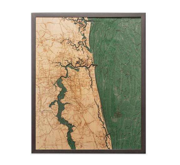
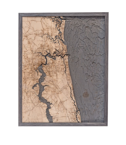
The 3D nautical wood map begins with Baltic birch laser-cut to create each layer of depth. A blue-green stain is applied to highlight the surrounding water, and points of interest are etched into the 3D wood map's surface for additional detail. A custom solid wood frame and acrylic sheet complete this one-of-a-kind nautical map.
Bring back memories of Jacksonville with this unique nautical wood map.
| Dimensions: | 24.5" x 31" |
| Material: | Baltic Birch wood & Plexiglass |
| Features: | 3D underwater topographic map (bathymetric chart) | Layered laser cut natural Baltic Birch wood | Carved relief of nautical terrain | Wooden chart work of art that will enhance any décor | Locations etched & highlighted | Color may vary slightly |
| Care: | Damp cloth wipe, do not use chemicals or detergents |