With a beautiful waterfront and picturesque skyline, Boston Harbor is a natural estuary in the Bay of Massachusetts. Measuring in at fifty square miles, with shorelines that extend 180 miles, the harbor itself is made up of 34 islands and contains one of North America's most prominent and historic ports. The Harbor is a beloved destination for locals as well as tourists from around the world. Looking out onto the Massachusetts Bay, the waterfront offers something for everyone. It includes nearly 40 miles of bike friendly pedestrian areas, Long Wharf harbor cruises, the New England Aquarium, the Christopher Columbus Park, as well as a plethora of fun shops and eateries where you can sample the famous New England Lobster Roll. The Boston Harbor also attracts many history buffs due to its iconic role in the American Revolution as the site of the Boston Tea Party.
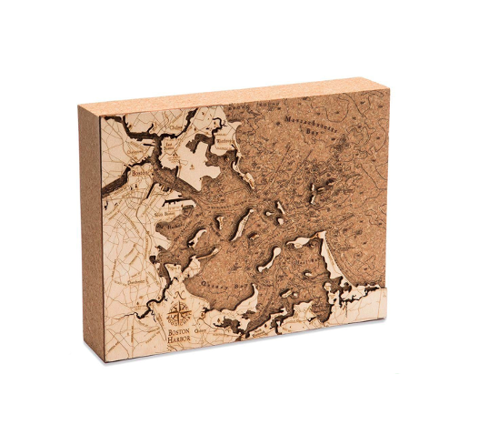
Our Boston Harbor Cork Map features the intricate shorelines of the port, using a mixture of Baltic birch and cork. The map face is laser-cut birch, and the depths of the water are expertly etched into the cork, creating a seamless view of the topographical detail of the harbor. The Boston Harbor Cork Map is finished with engraved points of interest and other well-known landmarks. It measures 8" x 10" and can stand up by itself on a tabletop or desk.