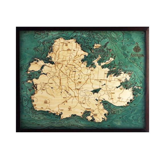
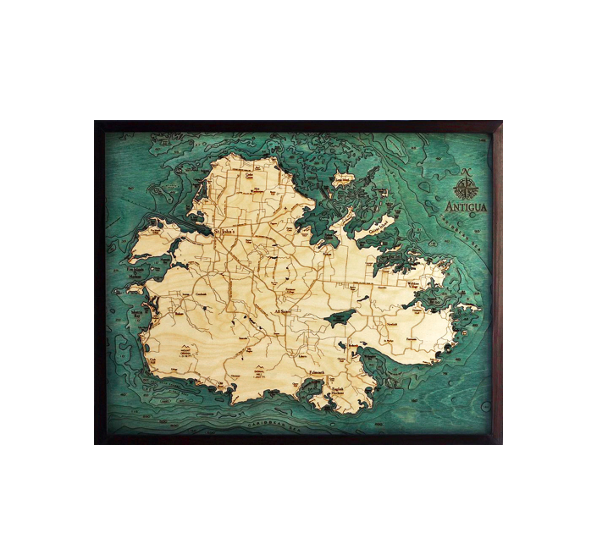
Antigua, known for being one of the sunniest islands, is in the Caribbean Sea and is the largest of the English-speaking Leeward Islands. Our 3-D nautical wood map displays the island’s incredible ocean terrain and showcases points of interest, including St. John’s, Falmouth, and English Harbour.
Each of our 3D nautical wood maps is created with the utmost attention to detail. The design begins by studying a bathymetric map to ensure each rise and fall of the ocean floor is documented within the laser-cut layers of Baltic birch that our customers know and love. The water surrounding the land is hand-stained before points of interest and landmarks are etched into the wood.
Daydream about white sand beaches and peaceful ocean waves with this beautiful 3D nautical wood map.
| Dimensions: | 24.5" x 31" |
| Material: | Baltic Birch wood & Plexiglass |
| Features: | 3D underwater bathymetric chart | Layered laser cut natural Baltic Birch wood | Carved relief of nautical terrain | Wooden chart work of art that will enhance any décor | Locations etched & highlighted | Color may slightly vary from picture |
| Care: | Damp cloth wipe, do not use chemicals or detergents |