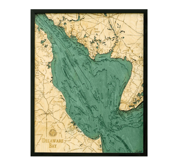
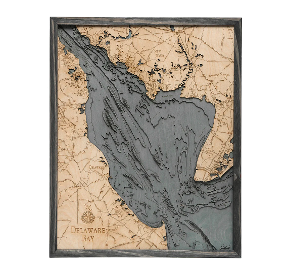
If you enjoy seafood, Delaware Bay is a prime destination for satisfying your cravings for horseshoe crabs and oysters. The bay is the estuary outlet for the Delaware River. It mixes with the saltwater of the Atlantic Ocean to create a unique breeding ground for all types of aquatic life. Transportation is also an essential aspect of importance, with the bay serving as the second busiest waterway in the United States behind the Mississippi River.
Delaware bay's depths are depicted in our 3D wood map using laser cuttings of Baltic birch that are glued together to create the dimensional effect that brings our maps to life. The water is hand-stained, and points of interest and major roadways are etched into the map’s surface. Each nautical wood map is finished with a custom wood frame and ultra-transparent acrylic to keep your map looking brand new for years to come.
Bring back incredible memories of Delaware Bay with our beautiful 3D nautical wood map.
| Dimensions: | 24.5" x 31" |
| Material: | Baltic Birch wood & Plexiglass |
| Features: | 3D underwater topographic map (bathymetric chart) | Layered laser cut natural Baltic Birch wood | Carved relief of nautical terrain | Wooden chart work of art that will enhance any décor | Locations etched & highlighted | Color may vary slightly |
| Care: | Damp cloth wipe, do not use chemicals or detergents |