Martha’s Vineyard sits just off the coast of Massachusetts and was initially known as Noepe by the Wampanoag Native Americans who first lived there. Known by locals as The Vineyard, the island’s highest population occurs during the summer when the seasonal population rises from 15,000 to over 100,000.
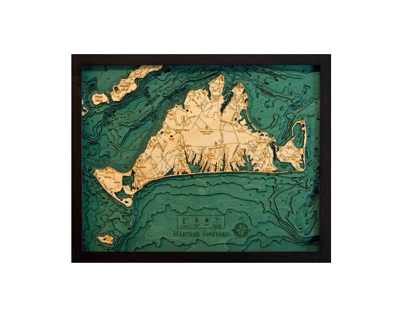
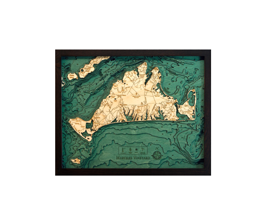
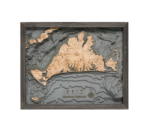
Our 3D wood map of Martha’s Vineyard begins as a bathymetric chart. The chart helps the artist accurately portray the topography of the island and its surrounding water. Pieces of Baltic birch are laser cut into the exact shapes of the island and water depths. They ar then glued together to form the beautiful dimension our wood charts are known for. The water is hand-stained and points of interest are etched into the surface. A custom size solid wood frame completes the nautical wood map.
Show off your love of Martha’s Vineyard with our beautiful 3D wood map.
| Dimensions: | 16" x 20" |
| Material: | Baltic Birch wood & Plexiglass |
| Features: | 3D underwater topographic map (bathymetric chart) | Layered laser cut natural Baltic Birch wood | Carved relief of nautical terrain | Wooden chart work of art that will enhance any décor | Locations etched & highlighted with special technique | Color may |
| Care: | Damp cloth wipe, do not use chemicals or detergents |