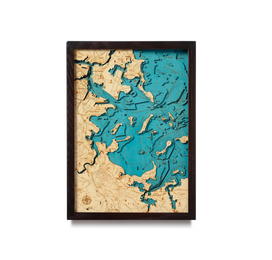
Boston Harbor is the estuary of Massachusetts Bay and includes beautiful islands, miles of shorelines, and wildlife. The harbor has served a memorable role in United States history, most notably as the site of the Boston Tea Party in 1773. Our 3D nautical wood map captures the unique look of the area as well as points of interest including Quincy Bay, Winthrop, and Little Brewster Island, home to America’s oldest lighthouse.
Each topographic wood map begins as a graph that documents the depth of the waters around the area. The bathymetric map helps designers create the specific outlines that will become the finished map. Once the lake art design is finished, the water is hand-stained either blue green or gray and points of interest and other landmarks are etched into the surface. The map is completed with a custom wood frame and a piece of durable, ultra-transparent acrylic.